covid disease interactive map that show disease spread based on picked date
Go to file
GitHub Action 45bf9a1622 Update csv data 2021-03-01 14:15:18 +00:00
.github/workflows Update cron cause EU doesn't care about public data 2021-01-24 13:22:25 +01:00
data Update csv data 2021-03-01 14:15:18 +00:00
.gitignore Initial commit with messy code 2020-04-05 22:12:53 +02:00
LICENSE Initial commit with messy code 2020-04-05 22:12:53 +02:00
README.md Update card.png screenshot 2020-04-06 00:18:19 +02:00
card.png Update card.png screenshot 2020-04-06 00:18:19 +02:00
download.csv.sh Update download.csv make executable 2020-04-06 06:43:53 +02:00
index.html Fix Greece and Kosovo 2020-04-22 21:32:29 +02:00
screenshot.gif Add README and screenshoot 2020-04-05 22:34:01 +02:00

README.md

Description

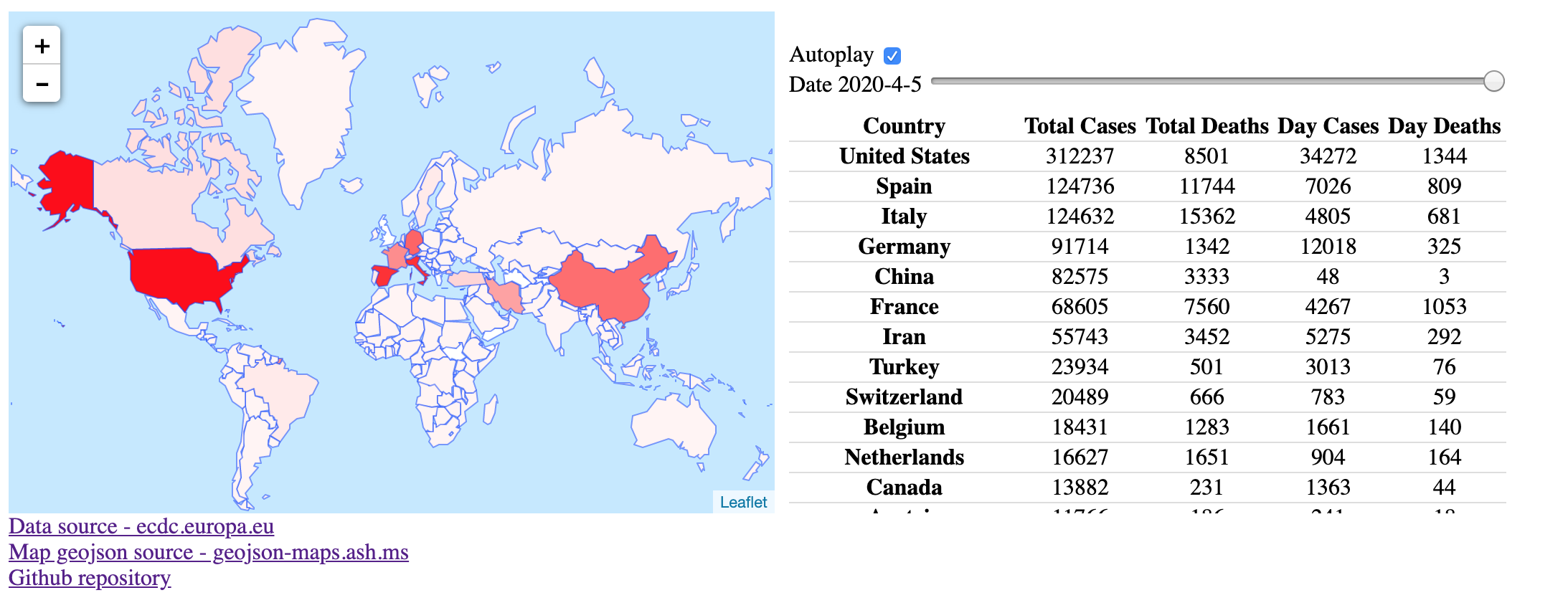
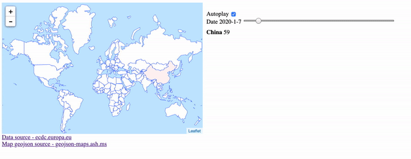
Shows disease spread from begginging till today using interactive world map.

Website demo Website demo

Thanks

Leaflet
Data source - ecdc.europa.eu
Map geojson source - geojson-maps.ash.ms